Historical version 6 of Covered Market (view current version)
- High Street (map of this place)
- oxfordcity.co.uk/shops...
- 8.30am - 5.30pm Monday to Saturday
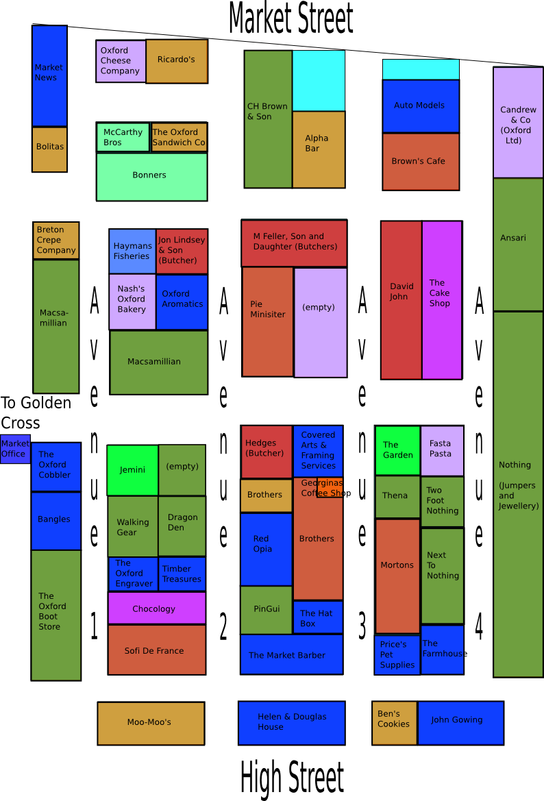 The covered market covers the area between Cornmarket and [Turl Street]? and [Market Street]? and High Street. The current layout of the market dates from the 18th Century although a market has existed in Oxford since at least the 12th Century. The covered market was created due to a desire to move stalls off the busy streets and into one central area.
It may seem unbelievable that this area once contained over a hundred stalls but originally the shops were much smaller with tiny fronts. Only a few shops remain in the market at the original size.
There are now around 60 shops in the market. There is a mix of food shops (Butchers, Grocers, Delicatessens etc), places to eat (Cafes, Sandwich shops etc), and shops (Clothing, Shoes, Florists, Gifts etc).
A full list of the shops in the market: View all pages in Locale Covered Market